Quick Info
Laguna Lake (Filipino: Lawa ng Laguna, Lawa ng Baé; English: Lake of Laguna, Lake of Baý, Laguna Lake) is the largest lake in the Philippines located east of Metro Manila between the provinces of Laguna to the south and Rizal to the north. The freshwater lake has a surface area of 911–949 km² (352-366 sq mi), with an average depth of about 2.8 metres (9 ft 2 in) and an elevation of about 1 metre (3 ft 3 in) above sea level. The lake is shaped like a stylized 'W', with two peninsulas jutting out from the northern shore. Between these peninsulas, the middle lobe fills the large volcanic Laguna Caldera. In the middle of the lake is the large island of Talim, which falls under the jurisdiction of the towns of Binangonan and Cardona in Rizal province.
Origin
Early geologists had diverse opinions regarding the origin of Laguna lake. Up to this time, the issue that the lake was previously a volcanic crater or that it originated through subsidence due to a volcanic eruption still needs supporting facts. A shallow crater at the southern end of Talim island can be found and serves as one evidence of its volcanic history, i.e., that Laguna lake is believed to have been formed by two major volcanic eruptions between 27,000-29,000 years ago.
Based on recent findings, Laguna de Bay was once a part of Manila Bay. This is evidenced by the discovery of drill cores of marine shell species which can also be found in Manila Bay. These species of marine shells can also be located in the upper shores of Bagumbayan (Luneta Park) and in the Marikina Fault in Pasig-Marikina River junction.
Uses
The lake is a multipurpose resource. In order to reduce the flooding in Manila along the Pasig River, during heavy rains, the peak water flows of the Marikina River are diverted via the Manggahan Floodway to Laguna de Bay, which serves as a temporary reservoir. In case the water level on the lake is higher than the Marikina River, the flow on the floodway is reversed, both Marikina River and the lake drain through Pasig River to Manila Bay.
The lake's most dominant use is on fisheries. It is estimated that the lake yielded 37,000 to 47,000 MT (metric tons) of fish in 1997 to 2000 - both from the fishpens and open fisheries. Crustaceans and mollusks declined in yield from 1,927 to 574 MT and from 101,101 to 85,363 MT respectively, during the same period. With the introduction of the fishpen culture technology in 1970, the boom in lake fishery production also led to social conflicts in the region. Large-scale fishpens have threatened the economic conditions of fishermen dependent upon open water fishery. To address the issue, a revised Lake Fishery Zoning and Management Plan was implemented in 1996.
LLDA set navigational routes for lake travelers and users to avoid conflicts with fish cultivators, fishpen owners, and free-range fishermen. More than 5,000 motorized and non-motorized watercraft operate as a means of transportation for lakeshore communities. In addition, there are 23 barges plying the lake to transport an average of 75,640 barrels of oil and oil products to various supply depots daily. Board Resolution no. 66 of 1998 - Approved the navigational routes for the ferry system in the Laguna lake.
Primary Lane - a 500 meter wide route going to Los Baños, and Pagsanjan, Laguna
Secondary Lane - a 400 meter wide route provides access to other municipalities around the lake including Talim Island
Tertiary Lane - a 200 meter wide route which lead to the existing landing areas in the municipalities.
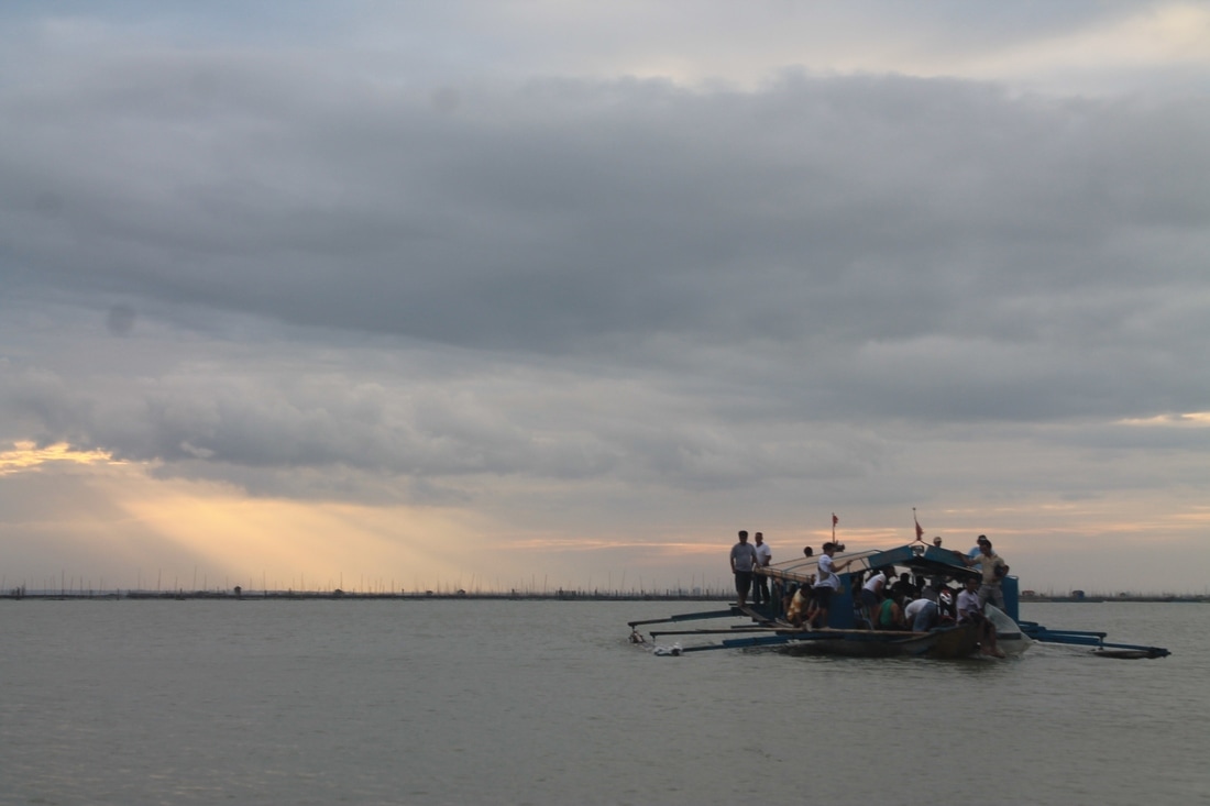
An over-loaded motorized passenger banca from Binangonan Wharf carrying passengers to Talim island. Fishpens and Metro Manila can be seen from the horizon.
Photo contributed by Neil Ojascastro.
Laguna lake also serves as a reservoir for floodwater to save Metro Manila from flooding. The Manggahan Floodway was constructed to divert floodwaters from Marikina River into the lake. The Napindan control station regulates the outflow of excess lake waters and minimizes the inflow of saline water and pollution from the Pasig River.
Laguna lake is also used for power generation; three power plants are located in the region. A pump storage hydroelectric power station is operated in Kalayaan, Laguna. Water is pumped up to the Caliraya Reservoir to generate about 300 megawatts of electricity. Efforts are underway to increase this capacity to 600 megawatts.
Laguna lake is also known for recreational activities. Although classified only for non-contact recreation such as fishing, boating and sailing, the lake is used for swimming in some communities. Lake shore resorts near Mt. Makiling extract hot spring waters for health spa and beauty treatment. LLDA also ventures on eco-tourism projects through the LISCOP Component 1 Project with 6 eco-enhancement projects in Rizal and Laguna Provinces namely:
A. Daranak Falls Eco-Tourism Project
B. Panguil Eco-Park (Ambon-Ambon Falls)
C. Pakil Eco-Tourism
D. Majayjay Eco-Tourism Project (Taytay Falls)
E. Cavinti Eco-Tourism Project (Magdapio Falls)
F. Siniloan Eco-Tourism Project (Buruwisan Falls)
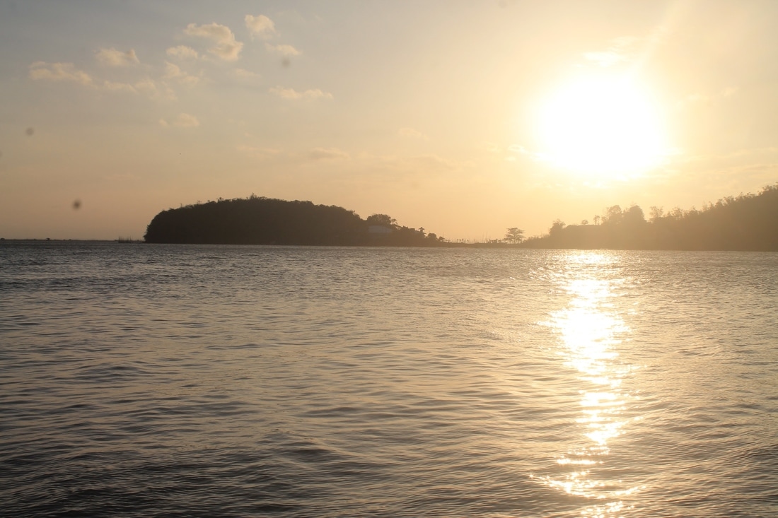
Sunset viewed from Talim island. Tapao Point and SEAFDEC building can be seen from the background.
Photo contributed by Neil Ojascastro.
Laguna lake also provides sufficient water for farm lands of the lake region. Studies are being done to further improve the use of lake water for agriculture.
Laguna lake is also being used as a source of industrial cooling water. Major users include the National Power Corporation for the Kalayaan Hydropower Plant and the Philippine Petroleum Corporation Refinery in Pililla, Rizal. KEPHILCO-Malaya Power plant also draws water from the lake for cooling. Cooling water is recycled back into the lake resulting in thermal pollution of about 20C rise in temperature near the discharge points.
Laguna lake also serves as a huge waste sink for solid and liquid waste coming from households, cropland areas, industries, livestock and poultry production as well as fishery activities. Because not a single municipality is equipped with a sewerage system, pollution is carried as surface run-off through the sub-basins of the lake. In addition, polluted waters from the Marikina and Pasig Rivers also flow into the lake.
Laguna lake is now a major resource that supplies the domestic water supply requirement of the nearby towns along the lake. This is supported by Board Resolution No. 338, series of 2007- “Declaring the Establishment and Operationalization of Water Permitting, Registration and Monitoring System for the Extraction of the Lake Waters of Laguna de Bay and other Bodies of Water within Laguna de Bay Region and for Other Purposes” and backed-up by the approval of the Implementing Rules and Regulations for Permitting Surface Water Abstraction in 2008. Water permit for Manila Water Services Inc. (MWSI) to abstract a maximum volume of 300,000 cubic meters per day has been approved in July 2009.
Known lake islands include Talim Island, the largest and most populated island on the lake; Calamba Island, which is completely occupied by the Wonder Island resort in Calamba, Laguna; Cielito Lindo, a privately owned island off the coast of mainland Cardona, Rizal; Malahi Island which used to be the site of Maligi Island military reservation, near the southern tip of Talim Island; the nearby islands of Bonga and Pihan, also in Cardona; and Bay Island off the coast of Bay, Laguna, which is closely associated with the precolonial crocodile-deity myths of that town.
Text content copied from:
Wikipedia article Laguna de Bay
https://en.wikipedia.org/wiki/Laguna_de_Bay
LLDA Official Website articles About the Lake and Lake Uses
http://www.llda.gov.ph/index.php?option=com_content&view=article&id=74&Itemid=475
http://www.llda.gov.ph/index.php?option=com_content&view=article&id=110&Itemid=476
Some changes were made.
See those pages' history for attribution.
Text content made available for this website through http://creativecommons.org/licenses/by-sa/3.0/
Next article - - - Rock Cycle
